Singapore has a number of treacherous tidal streams around our coastline, combine this with bad weather and unfamiliar terrain, this can become a recipe for disaster. Before you go into the water you must be aware of the tides, the location you will be, and the weather prediction that you could face. Here is our quick list of Singapore Weather Charts and Tides sources, please let us know if you have another source that we should include of if you would like to know more about Singapore Weather Charts and Tides you can email us.
Weather in Singapore
Windy is one of the most detailed weather APPs available, it’s a must have if you are planning a trip locally. Weather.gov.sg is another good source of accurate real-time weather in Singapore.
Charts for Singapore
For charts, it is hard to go past Navionics, this will give you everything you need for cruising locally. With that said, if you want to have all the updated and correct restricted areas, you should pick up the latest “Charts for Small Crafts” book.
Tide Tables for Singapore
There are over 10 different tide variants in Singapore, for the generic tide you can visit the National Environment Agency, for localised area’s we suggest to check with your local marina. ONE15, RSYC, Raffles, SAF and Changi. Tide Charts website is also a good source of tide details for the rest of Southeast Asia. Check them out here: https://www.tideschart.com/Singapore/
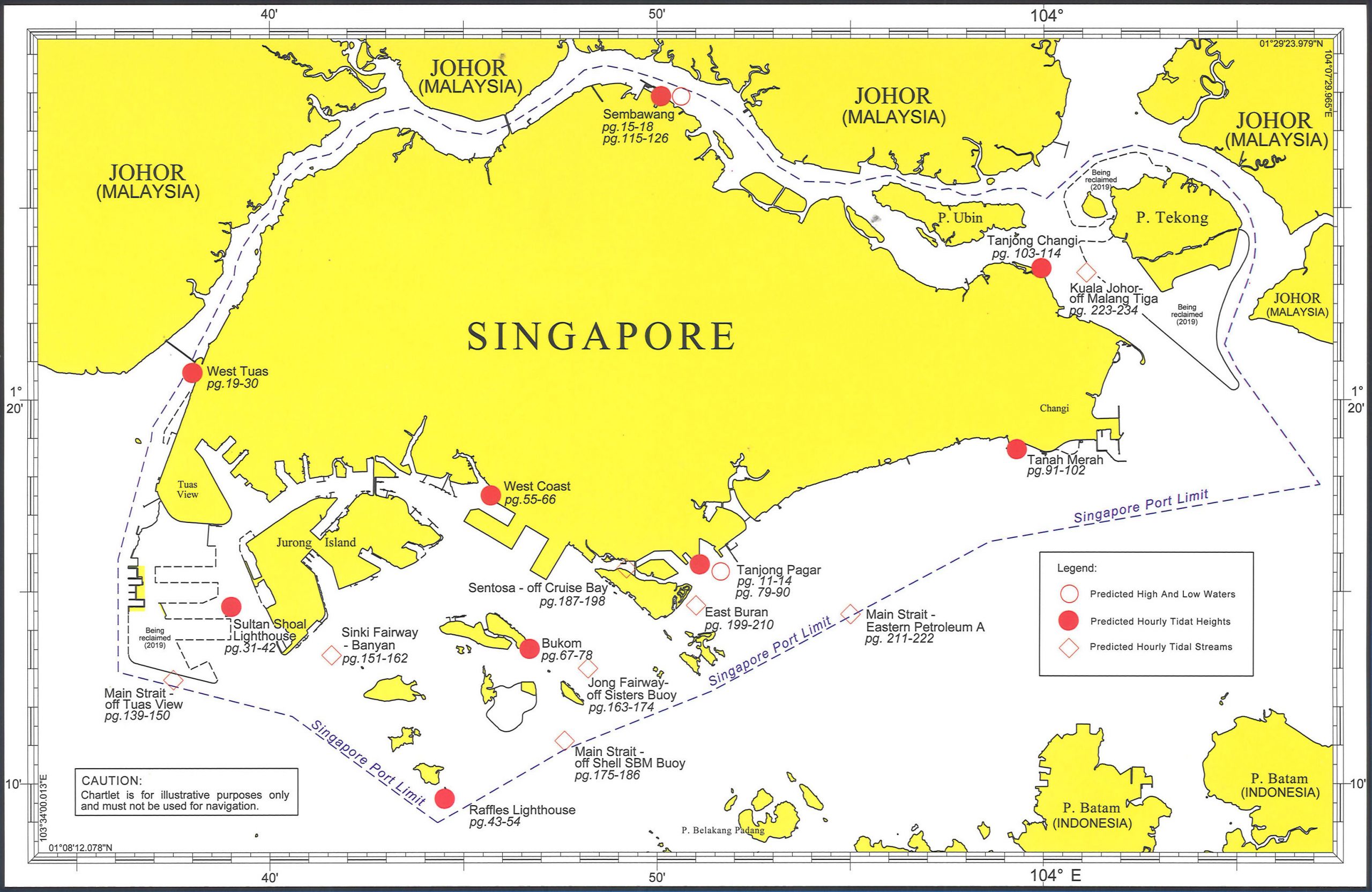
Singapore has mostly “mixed semi-diurnal tides”, e.g two high tides (and low tides) of a day are not of equal height. Each side of the causeway will give you quite simple tide streams, it will Flood up to the causeway at High Tide and Ebb out from the causeway at Low Tide. For the South of Singapore, the Southern tip of Tuas to the Southern tip of Changi, you can get by understanding High Tide (Flooding Tide) will come from the East, and Low Tide (Ebbing Tide) will come from the West. There are 5-6 unique tide streams in the South, these tidal streams are influenced by the landscape and a meeting of the same tide at a different heights from a different directions.
Here a map of the tidal streams from the Singapore Weather Charts and Tides


